GeoSTORM is a sophisticated engineering software that supports numerous stormwater hydrology models and methods within a 2D and 3D AutoCAD, MicroStation, and GIS environment. GeoSTORM greatly speeds up the process of creating, analyzing, and reviewing urban and rural stormwater models. It can be used to analyze both simple and complex stormwater systems.
GeoSTORM is an AutoCAD, MicroStation and ESRI ArcGIS compatible interactive 2D/3D graphical user interface data wrapper to the EPA SWMM stormwater software.
Reduce time waster with imprecise or incomplete data, including survey data, LiDAR, Civil 3D and MicroStation drawings and terrain surfaces, aerial maps, ArcGIS data, and much more.
Work with multiple stormwater projects simultaneously using the Multiple Document Interface (MDI), including copying and pasting of stormwater structures and other data between stormwater projects.
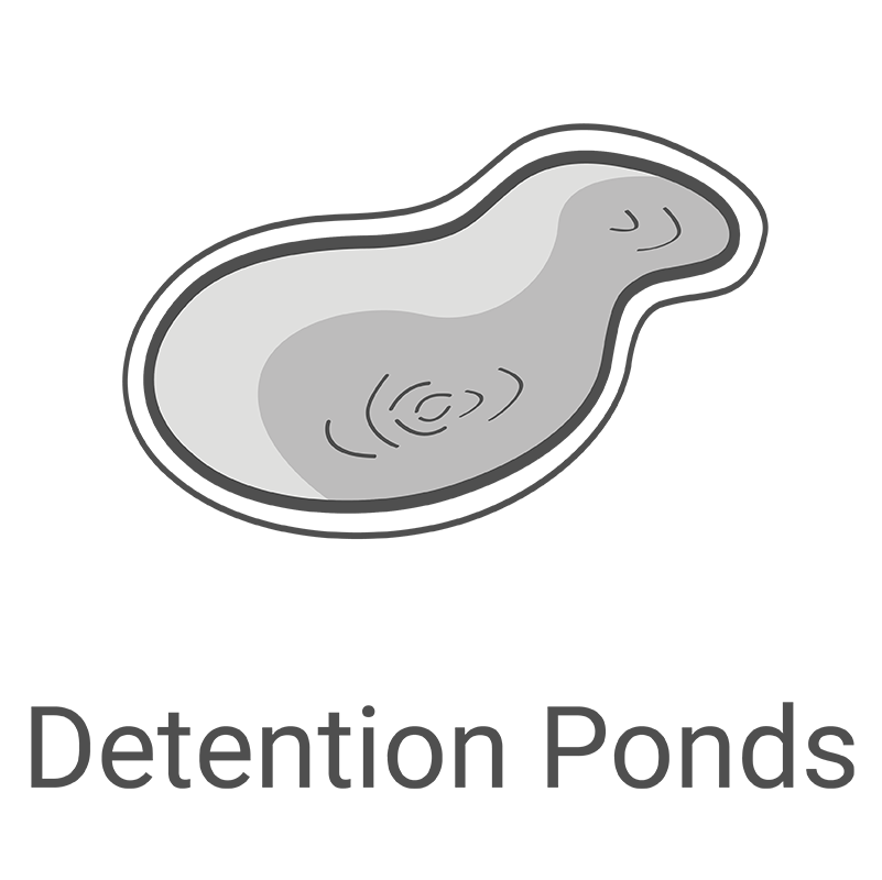
Interact graphically with all stormwater model elements. Effortlessly create and edit subbasins, catch basins, manholes, junction boxes, pipes, ditches, streams, culvert roadway crossings, detention ponds, underground storage chambers, and other model elements by clicking and dragging. Uncomplicated dialog boxes allow easy data entry and review.
Reduce errors and modify model parameters as needed by easily exchanging data across multiple teams. Improve design quality and intent with other stakeholders with a digital twin 3D stormwater model for streamlined design and documentation workflows. Work in real-world coordinates to seamlessly share simulation models and results with other digital twin software platforms.
The software provides an innovative and modern approach to stormwater engineering by automating many of the tedious and manual tasks typically required to create, design, iterate, analyze, and submit a stormwater model. This provides a fresh approach for stormwater engineering analysis, enabling the stormwater project to be rapidly and efficiently completed while maintaining high levels of model detail.
GeoSTORM is an AutoCAD, MicroStation and ESRI ArcGIS compatible interactive 2D/3D graphical user interface data wrapper to the EPA SWMM stormwater software. Integrate AutoCAD drawing files, Bentley MicroStation drawing files and ESRI ArcGIS map data. Export completed model results showing flooding limits and depths to AutoCAD (including AutoCAD Civil 3D), MicroStation, and ESRI ArcGIS.
GeoSTORM includes the Rational Method, Modified Rational Method, SCS TR-20/
TR-55, HEC-HMS, EPA SWMM, CUHP (Colorado Urban Hydrology Procedure), SBUH (Santa Barbara Urban Hydrograph) and many other stormwater hydrology analysis engines. Choose the hydrology method best suited for your modeling conditions.
The software can import and utilize a large variety of data, including survey data, LiDAR, Civil 3D and MicroStation drawings and terrain surfaces, aerial maps, ArcGIS data, and much more.
Work with multiple stormwater projects simultaneously using the MDI (Multiple Document Interface) user interface, including copying and pasting of stormwater structures and other data between projects. Load, edit, and run multiple stormwater models simultaneously.
Blend Google and Microsoft Bing online maps along with high-resolution aerial imagery files directly into the stormwater model. Quickly and easily georeference AutoCAD and MicroStation drawings, or ArcGIS map data. Integrate provided cloud-based land use maps, soil maps, FEMA flood maps and much more into the model.
Shift seamlessly between 2D and 3D viewing perspectives to clearly identify modeling issues and make changes. Freely rotate, pan, zoom, and fly through the model to any perspective to review subbasins, pipe networks, detention ponds, routing reaches and more.
Delineate watersheds, subbasins, and catch basin capture areas from 3D digital elevation terrain data. Utilize AutoCAD Civil 3D surfaces, MicroStation surfaces, contours, TINs, DTMs, DEMs, survey points, LiDAR, and other external digital elevation terrain data.
Perform simultaneous critical storm analysis, examining different storm frequencies and durations to determine which storm creates the most critical conditions that need to be designed for. Engineering work that would normally take days can be completed in just minutes.
Integrated stormwater design tools offer a more efficient way to create and analyze a stormwater project, compute catch basin locations, size and design detention ponds, and more. Update subbasin catchment boundaries dynamically as terrain data are changed.
Using the software’s cloud data services, major foundries such as Neenah, East Jordan, and others have their catch basins and corresponding hydraulic capture-bypass curves included in the stormwater element catalog. All state DOT along with major city and county mandated catch basins are included.
Extract routing reach cross sections from 3D digital elevation terrain data. Utilize AutoCAD Civil 3D surfaces, MicroStation surfaces, contours, TINs, DTMs, DEMs, survey points, LiDAR, and other external digital elevation terrain data.
For large models with numerous subbasins, catch basins, manholes, pipes, reaches, and other stormwater elements, the software will automatically name the elements based upon user-specified guidelines. The elements are named sequentially, by routing distance or incrementally..
Using the software’s cloud data services, automatically determine the design storm and corresponding precipitation based upon project location anywhere within the USA, Canada, and many parts of Europe. It will determine the design rainfall for the 1, 2, 5, 10, 25, 50, 100, and 500-year storms.
Select from numerous TOC (Time of Concentration) methods built into the software, including NRCS (SCS) Velocity, NRCS Lag, Kirpich, Kirby, FAA, Kinematic Wave, and more. This allows the TOC to be quickly computed for subbasins and catch basin drainage areas.
Quickly compute composite runoff coefficients (RC), SCS curve numbers (CN), Green Ampt values, and percent imperviousness based upon aerial mapping, GIS land use polygons, or just by painting regions of land use on the screen.
Utilize the software’s cloud data services for LiDAR-derived elevation terrain, aerial orthophotos, land cover, soil maps, FEMA flood maps, watershed delineation, river centerline alignment, and more for the USA, Canada, much of Europe and other parts of the world.
Complete land use coverage for the USA, Canada, Europe, Australia and many other parts of the world is provided with the software’s cloud data services. For the USA, land coverage data are provided at a 100 x 100-foot grid cell size.
Complete percent imperviousness coverage for the USA at an approximate 100 x 100-foot grid cell size is provided with the software’s cloud data services. This allows a more accurate stormwater model to be developed, integrating effects of urbanization directly into the stormwater model.
Get up to speed quickly delineating drainage catchment areas for incoming projects. World-wide high-resolution 3D digital elevation terrain data for automated watershed delineation, time of concentration computation, and more are provided with the software’s cloud data services.
Develop and compute stormwater results directly within the software, no external data processing required. Model everything from simple 1D stormwater models to complex 1D-2D urbanized stormwater models.
Compare different engineering models, such as existing and proposed development, different detention pond designs and more. This capability allows stakeholders to evaluate different design alternatives, allowing innovative and environmentally sensitive designs to be considered.
Create stunning visualizations directly from the software of different design alternatives. Facilitate an understanding of the impact of the design on the community and the surrounding environment.
To improve productivity, the stormwater results computed within GeoSTORM will seamlessly migrate to GeoHECRAS. This greatly increases the speed at which users can perform HEC-RAS flood studies, design bridge and culvert roadway crossings, compute dam failures, and complete stream restoration and alignment projects.
Import previously developed XPSWMM models into GeoSTORM and maintain existing stormwater model fidelity. No need to move to unsupported software vendors. Our technical engineers are expert SWMM modelers, allowing you to maintain your investment with your calibrated XPSWMM model.
Correct mistakes easily with unlimited Undo and Redo capability. Experiment with different engineering and management decisions. Rollback changes one at a time or select a group of changes from a visual selection list.
Handle large projects with powerful 64-bit, multi-core, parallel processing support. This capability improves performance and stability for memory-intensive tasks—including running multiple stormwater simulations faster.
GeoSTORM is a graphical data wrapper to the EPA SWMM software, a FEMA approved model for National Flood Insurance Program (NFIP) studies. The completed model can be exported and submitted to reviewing agencies, with the added security of knowing that the results will be accepted for urban and regional flood studies.
Toll-free 24-hour 7-day a week unlimited technical support by experienced water resource engineers is just a phone call or Zoom/MS Teams meeting away. Quickly resolve your stormwater modeling questions and complete your engineering projects on time—our skilled, professional engineers are available to assist you.
1-800-301-02-955
608-729-5100
(US and Canada)
[email protected]
+1 608-729-5100
–
–
–Tel:
CivilGEO India
Graphix Tower, A-13 A
3rd Floor, Sector 62
Noida, Uttar Pradesh 201309
IndiaTel:
1-800-301-02-955 or
+91 022-3831-8601
Copyright © CivilGEO, Inc. All rights reserved. The CivilGEO logo, “GeoSTORM”, “GeoHECHMS”, “GeoHECRAS”, and “Ready To Engineer” are registered trademarks of CivilGEO,Inc.
All other brands, company names, product names or trademarks belong to their respective holders.
We use cookies to give you the best online experience. By agreeing you accept the use of cookies in accordance with our cookie policy.
When you visit any web site, it may store or retrieve information on your browser, mostly in the form of cookies. Control your personal Cookie Services here.